

Drone Photography & Aerial Imaging
See Your Property from a Better Perspective
High-quality aerial photography that adds clarity, context, and visual impact to residential properties.
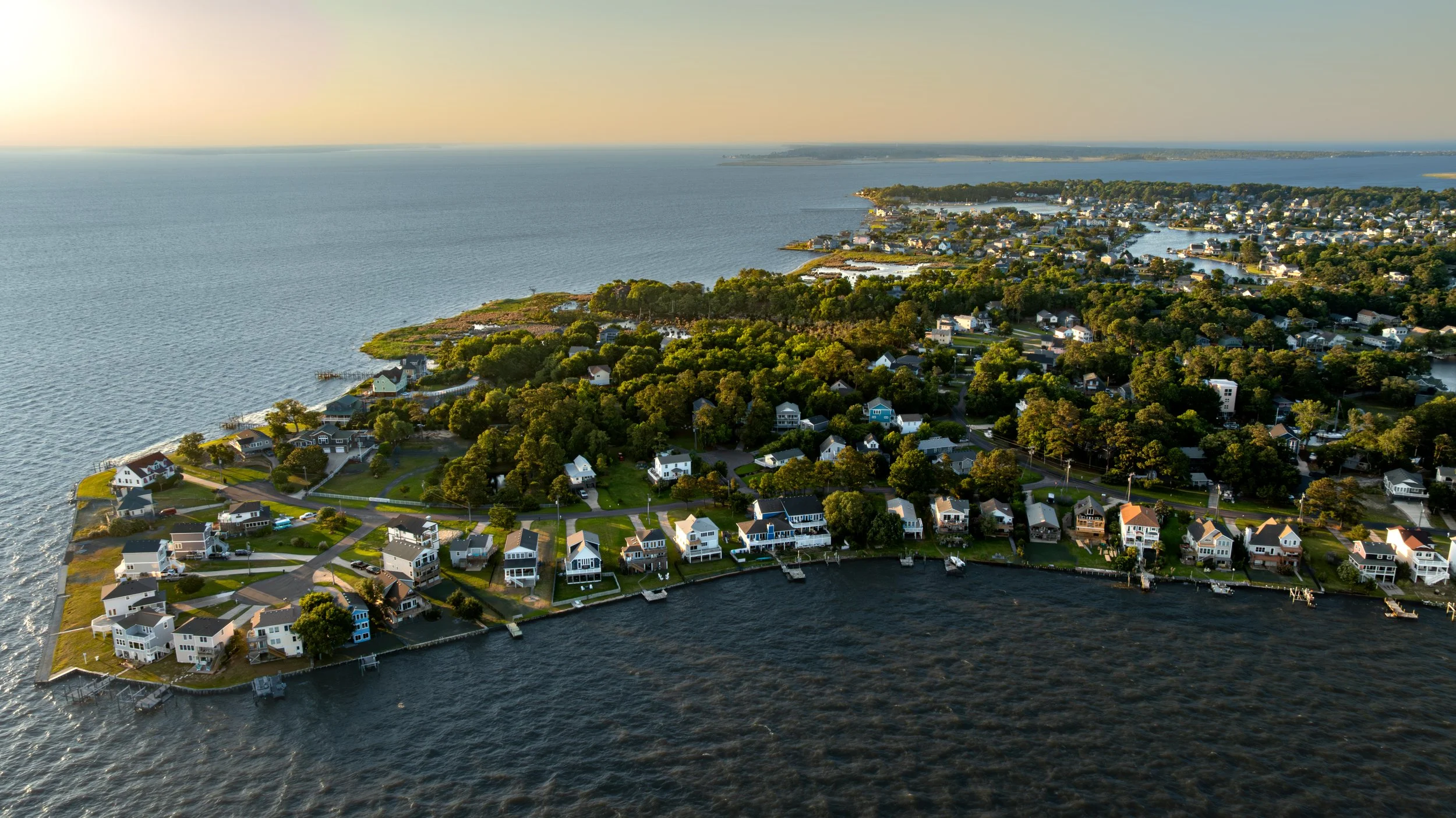
Neighborhood-scale aerial showing property context, water features, and surrounding development.
High-quality aerial photography that adds clarity, context, and visual impact to residential properties… Whether for real estate marketing, design context, or documentation, aerial imagery helps tell the full story of a home and its site
PROPERTY & NEIGHBORHOOD CONTEXT
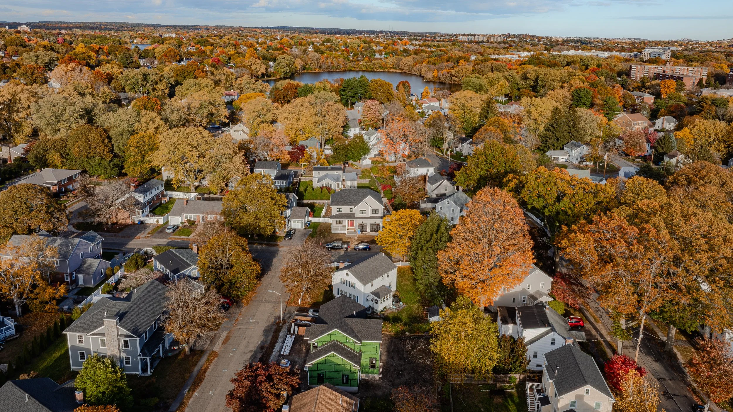
House-centered aerial illustrating relationship to nearby water, streets, and adjacent properties.

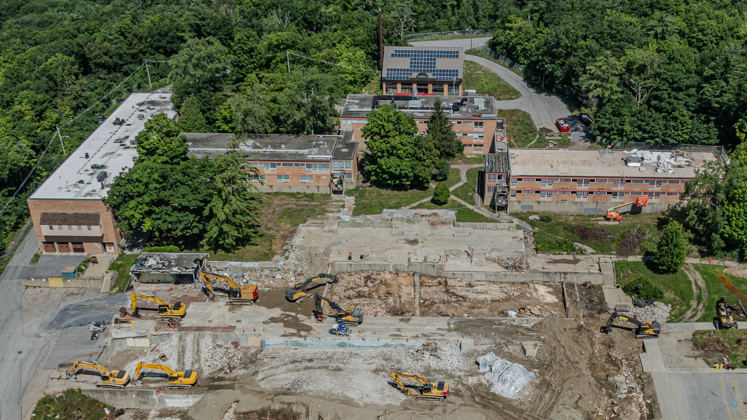
Site context aerial highlighting nearby infrastructure, institutions, and real-world constraints.
Typical imagery provided
Exterior aerial photographs of single-family and multi-family homes
Yard, lot, and property boundary context
Relationship to neighboring properties, streets, and landscape features
Elevated views that support listings, marketing, or project documentation
EXISTING CONDITIONS & DOCUMENTATION
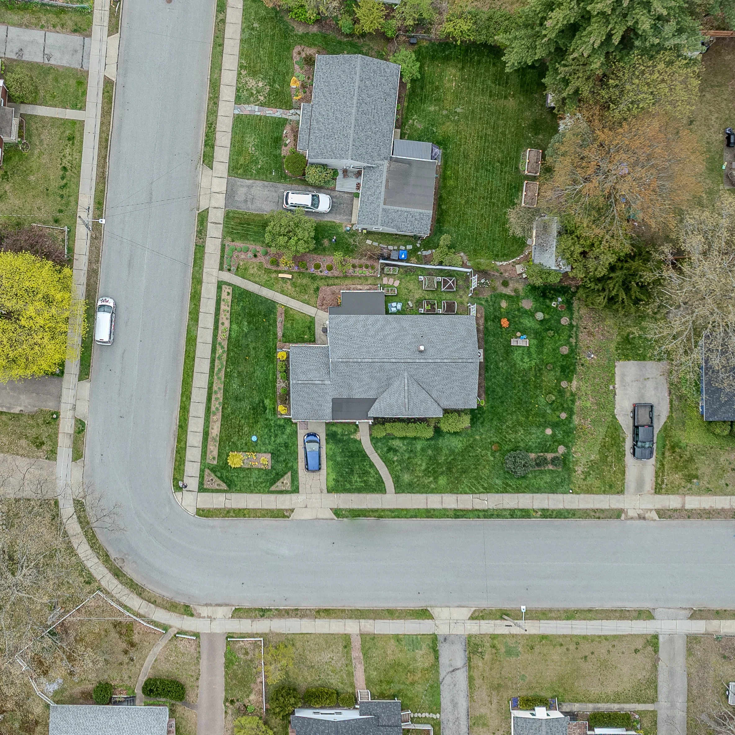
Straight-down aerial used for existing conditions documentation and site planning.
Orthographic-style aerial supporting as-built drawings, lot analysis, and early design studies.
COMMUNITY / VILLAGE SCALE
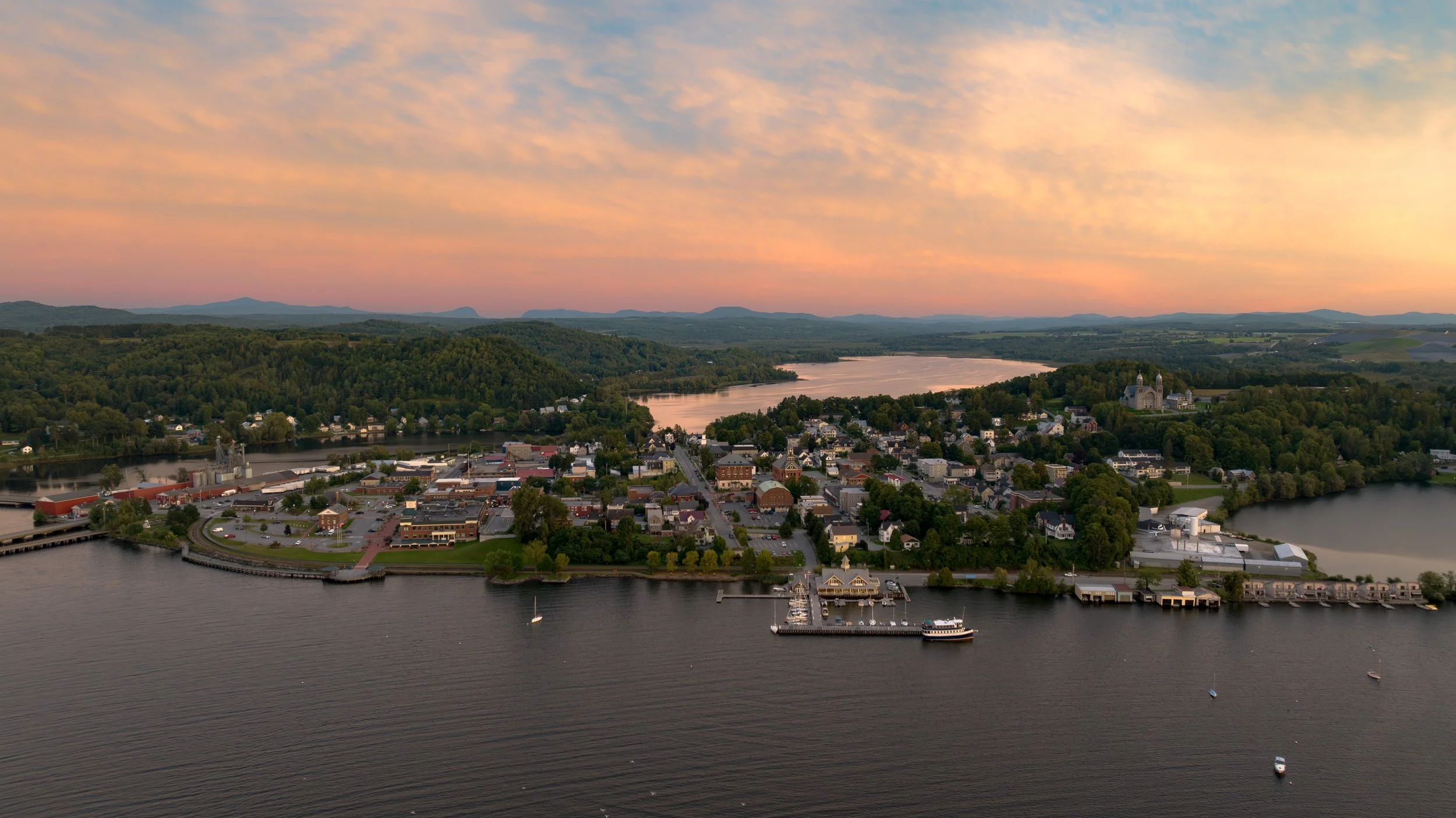
Village-scale aerial capturing street layout, building density, and surrounding landscape.
MARKETING & PRESENTATION
Residential aerial suited for marketing, presentation, and property overviews.
Clean, natural imagery suitable for MLS, Zillow, and real estate marketing
Useful site context for renovations, additions, and early design studies
High-resolution files optimized for web, print, and presentations
FAA-licensed and compliant drone operation with a focus on safety and professionalism
Designed for Marketing, Planning, and Presentation
All drone services are performed by an FAA-licensed remote pilot.